


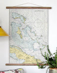
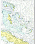

Bahamas Chart Scroll
$ 79.95
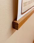
Beautifully printed on 80# text weight paper (28" x 20"), this chart covers the Bahamas and the surrounding waters, including Grand Cayman Island, Cuba, Haiti, Florida and the Florida Keys. It ships in a tube and arrives with a simple scroll kit so it hangs flat, no frame needed.
Most of our maps and charts are from 1930-1967, the Golden Age of American Cartography, when charts were still being drawn by hand.
Each chart is digitally restored in beautiful color and is not intended for navigation. Made to order in the USA, ships in about two weeks.